Wednesday, March 9, 2016 Dan McShane
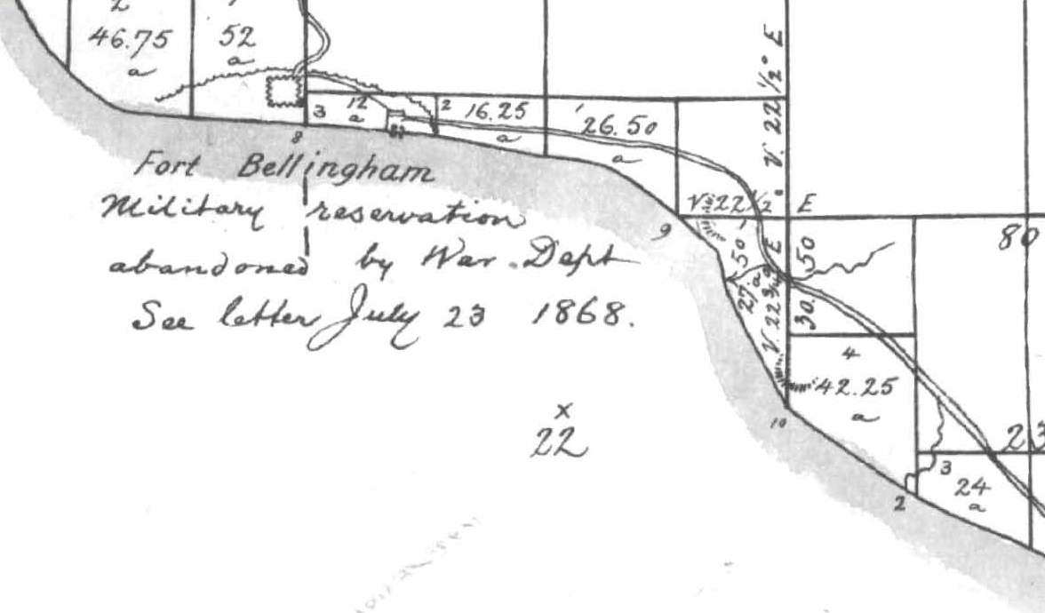
A little shore bluff history review of the north shore of Bellingham Bay shows that shoreline indicates that this a very dynamic area. Click on the images to make them larger. Continue reading

Wednesday, March 9, 2016 Dan McShane
A little shore bluff history review of the north shore of Bellingham Bay shows that shoreline indicates that this a very dynamic area. Click on the images to make them larger. Continue reading
 9 hrs August 9, 2015 Wendy Harris
Ask Dan McShane. His article on the on-going Swift Creek landslide is interesting and relevant on several points. Continue reading
Tuesday, July 7, 2015 Dan McShane

Haystack rock south of Highway 2 on the Waterville Plateau This large boulder marks the approximate southernmost reach of glacial ice.
The farthest south extent of the continental ice in central Washington during the ice age was the Okanogan ice lobe. The ice flowed down the Okanogan valley blocked the Columbia River and extended south across the Waterville Plateau. Continue reading

You must be logged in to post a comment.